Showing posts with label São Paulo. Show all posts

Friday, September 30, 2016

Empty spaces in the crowd: Residential vacancy in São Paulo

Nadalin, V., & Igliori, D. (2016). Empty spaces in the crowd. Residential vacancy in São Paulo’s city centre. Urban Studies, DOI: 10.1177/0042098016666498.

Abstract
In the past decades, when São Paulo became the national manufacturing centre, it has experienced great population growth. Since then, many housing problems have emerged. In addition, the difficulties that inner cities face in attracting jobs and maintaining economic activities are particularly challenging. Indeed, even if many cities have successfully regenerated their central areas, the so-called inner city problem is still very much alive in the case of São Paulo. As a result although the city centre has abundant urban infrastructure it still has plenty of vacant spaces, including residential buildings. One could say that São Paulo’s city centre is characterised by a large number of empty spaces in an area that is simultaneously crowded with buildings and urban facilities. This paper intends to contribute to the empirical analysis of the determinants of vacancy rates, with a particular focus on historical city centres, using São Paulo Metropolitan Area as our case study. Our empirical analysis relies on district-level data for the years 2000 and 2010, and combines standard spatial econometric methods with hedonic modelling. Our results suggest that there are three main groups of determinants: individual buildings characteristics, mobility of households and neighbourhood quality. We find evidence that the historic central city is a distinctive submarket, needing special urban policies. Its determinants work differently when compared with the housing markets of other areas across the city.
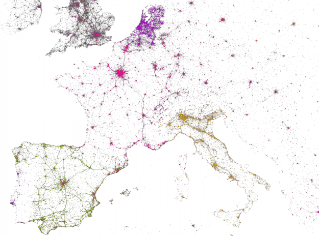
credit: Nadalin & Igliori, 2016

Sunday, June 23, 2013

Urban Picture

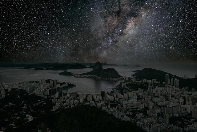
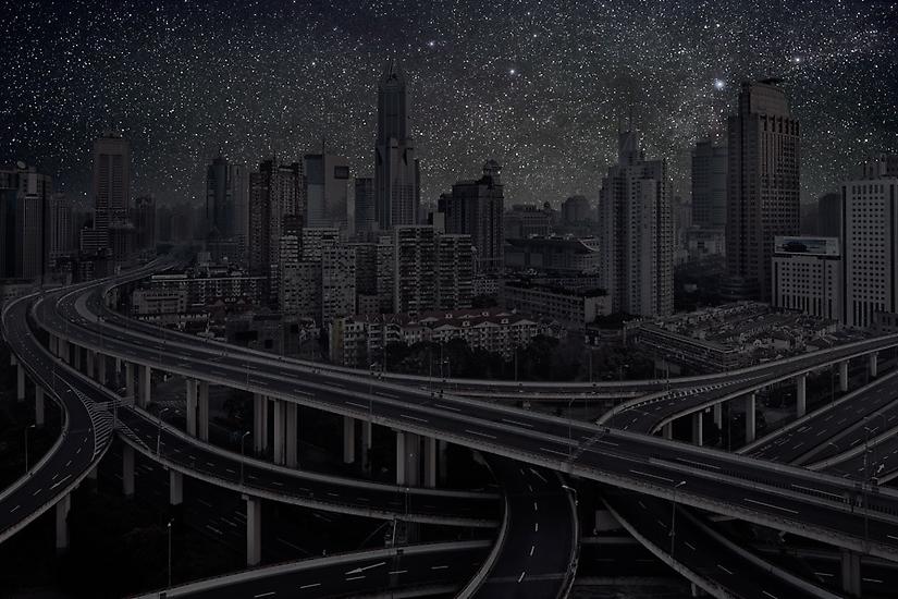
What world cities would look like at night with no light pollution?
A project by Thierry Cohen.

Rio de Janeiro


San Francisco


Shanghai


Paris


São Paulo


Thursday, August 11, 2011

off-topic: São Paulo CBD

I have just come back from a work trip to São Paulo*. I ran into this as I walked through the CBD. 
[Photo credit: Rafael Pereira using qbro]

*Where I was promoting the book "Urban-Regional Dynamics - Urban Network and its Interfaces" (my poor translation )

Tuesday, May 3, 2011

Assorted Links - Booming Metropolis


#12 Rio de Janeiro
#3 Mexico City
#2 São Paulo
#1 London

  • Urban World: Mapping The Economic Power Of Cities - a not
    not so new
    report from the McKinsey Global Institute explores 600 urban centers over the next 15 years15 years. "[...] the center of gravity of the urban world will move south and, even more decisively, east (thanks Waldery Rodrigues Junior for the tip)


Tuesday, January 25, 2011

São Paulo Urbanization (1957-2007)

Folha.com (what could be considered the equivalent of the New York Times here in Brazil) is publishing special articles on the 457º Anniversary of the City of São Paulo.

The articles are written in Portuguese. But you can enjoy a few images of São Paulo Urbanization here.

Guarapiranga dam

(photo credit: Base Aerofogrametria)


The planned neighborhood of Vila Formosa.
make gif animation
(photo credit: Base Aerofogrametria)

You can visualize other areas here (lazy link).

There is also a "before and after" session with pictures of São Paulo central area.

ps. Happy Birthday São Paulo !

Thursday, November 4, 2010

Social Geography of Votes in Brazil

Now at the intraurban-scale: these maps show the Brazilian Election results* by electoral zones for São Paulo e Rio de Janeiro.

Nelson Rojas and Luiz Cesar Ribeiro (from Observatório das Metrópoles) discuss the social polarization over space that emerges from these election results (here, in portuguese). The main conclusions drawn by the authors is that:

  1. The maps of 2010 election results are very similar with the electoral map of 2006 - the last confrontation between the PSDB (right wing) and the PT (left wing); and

  2. In both cities PSDB clearly had more votes in the more affluent urban areas meanwhile PT had an overwhelming victory in the depressed urban areas.
[it looks to me that the "Social Geographies of Votes" at regional and intraurban scales are similar to some extent. As a rule PSDB has the preference of richer araes, PT has the preference of deprived ones]


* ps. update regarding the last post: this is the best map of Brazilian Election results by municipality. It's possible to filter results by GDP, homicide rate, % of population receiving Bolsa Família benefits, etc. (tip from a friend of mine: Mauro Oddo, the best storyteller).


    (maps by Estadão via Observatório das Metrópoles)