Johnny Harris (Vox) has filmed a great series of short-videos that helps us understand the urban landscape of Hong Kong. In one of these videos, Johnny talks about how one of the most unaffordable housing markets in the world is driven by government's land-use regulations. The videos also cover the decline of Hong Kong's neon nightscape and even how feng shui shapes the city skyline. There is also a very informative one about the changing relationship between Hong Kong and China. You can check the list of videos below.
Showing posts with label Land Use. Show all posts
Showing posts with label Land Use. Show all posts
Sunday, August 19, 2018
Tuesday, May 22, 2018
Using deep learning and satellite imagery to improve land use classification in cities
Marta Gonzalez and colleagues have a recent paper using deep learning and satellite image data to improve land use classification. The authors have made documented code and Jupyter notebooks available here. I'm self recommitting the paper and code to my future self. HT Marco De Nadai.
Abstact:
Albert, A., Kaur, J., & Gonzalez, M. C. (2017, August). Using convolutional networks and satellite imagery to identify patterns in urban environments at a large scale. In Proceedings of the 23rd ACM SIGKDD International Conference on Knowledge Discovery and Data Mining (pp. 1357-1366). ACM.
Abstact:
Urban planning applications (energy audits, investment, etc.) require an understanding of built infrastructure and its environment, i.e., both low-level, physical features (amount of vegetation, building area and geometry etc.), as well as higher-level concepts such as land use classes (which encode expert understanding of socio-economic end uses). This kind of data is expensive and labor-intensive to obtain, which limits its availability (particularly in developing countries). We analyze patterns in land use in urban neighborhoods using large-scale satellite imagery data (which is available worldwide from third-party providers) and state-of-the-art computer vision techniques based on deep convolutional neural networks. For supervision, given the limited availability of standard benchmarks for remote-sensing data, we obtain ground truth land use class labels carefully sampled from open-source surveys, in particular the Urban Atlas land classification dataset of $20$ land use classes across $~300$ European cities. We use this data to train and compare deep architectures which have recently shown good performance on standard computer vision tasks (image classification and segmentation), including on geospatial data. Furthermore, we show that the deep representations extracted from satellite imagery of urban environments can be used to compare neighborhoods across several cities. We make our dataset available for other machine learning researchers to use for remote-sensing applications.

Thursday, September 5, 2013
New York City Land Use
Alasdair Rae has done some great maps of land use patterns in the city of New York. The maps are based on the Property Land Use Tax lot Output (PLUTO) dataset. You should check them out (the maps and the dataset!).

Related Link:
[click on the image to enlarge it]

[Image Credit: Alasdair Rae]
By the way, Alasdair has a history of making great 3D Density Maps:
Related Link:
Sunday, May 5, 2013
Assorted Links
- GPSing Your Cat
- London’s Changing Population
- Perhaps you should reconsider your PhD topic (via MR)
- Two good reasons to make a trip to China
- Is there a shortage of STEM workers in the USA? Yes, No, Depends
- Home prices in some U.S. metropolitan areas
- The new issue of the Journal of Transport and Land Use is out
- "WTF" link: Richard Nixon and Robocop ?!
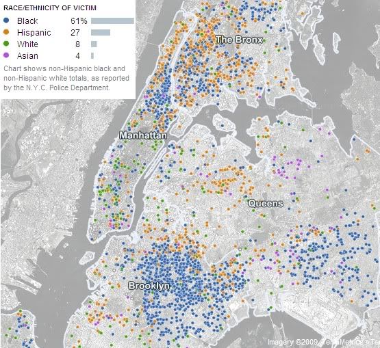
- An
oldinteractive map with lots of info on murders in NY
Subscribe to:
Posts (Atom)