Friday, January 31, 2014


Thursday, January 30, 2014
Accessibility Observatory + GTFS data

David Levinson, Andrew Owen and their team at the University of Minnesota have recently created the Accessibility Observatory. If you're interested in the topic, you may read a nice piece written by Emily Badger for TAC.
One of the greatest aspects of this project is about the data sources and methods they use for accessibility evaluation. Instead of relying on traditional household travel surveys, they combine open source data from OpenStreetMap (OSM) and from General Transit Feed Specification (GTFS), developed by Google. With this sort of data it is possible to analyze jointly the public transport system as a whole (routes, stops, and schedules) plus pedestrian routes and walking times. There is a more detailed explanation of how it works here.
I've bee thinking a lot about this 'empirical strategy' since I'm planning to dedicate part of my PhD to research socio-spatial inequalities in the distribution of accessibility. The more I think about this, the more I become a passionate skeptic, more passionate than skeptic.
To be honest, I believe that these data/methods are probably not going to revolutionize accessibility research in transport studies. However, this new 'empirical strategy' allows us to expand accessibility analysis so as to incorporate hundreds of cities where no travel survey has been undertaken. It also provides a tool with great potential to compare accessibility levels across space and time and to assess how certain modifications in the public transport system can affect accessibility levels. Not to mention the research questions you could address by combining these data/methods with Census data.
By the way, the use of GTFS in accessibility analysis is quite new. I have found a few applications that have been using GTFS since 2010 but none seems to be as advanced the Accessibility Observatory at Minnesota. Here is a list with some of those other initiatives:
- Stefan Wehrmeyer started in 2010 a project called mapnificent. Today it has perhaps the most comprehensive collection of cities so far.
- Comercial initiatives by Trulia in the US and by Mapumental in the UK.
- In 2011, Brookings Institution published the report 'Missed Opportunity - Transit and Jobs in Metropolitan America' analysing job accessibility based on GTFS for 100 metropolitan areas in the US.
- Renato Vieira and Haddad (2012) proposed a similar approach to build an accessibility index to São Paulo.
In 2013 we saw many more initiatives:
- Yuval Hadas published a paper in the JTG: Assessing public transport systems connectivity based on Google Transit data
- WNYC came up with this map of Transit times in NYC
- Andrew Hardin has also created his version of the map covering four other cities. Here is a recent study where he explains how he calculates city wide travel times by simulating walking and public transit
- and finally, Sean Barbeau and Aaron Antrim wrote a nice piece on the many uses of GTFS data (slides)
I must be missing some other initiatives and publications, so please leave a comment to this post with suggestions and links if you remember any.
[image credit: Transit Accessibility for the Minneapolis St. Paul region from the Accessibility Observatory]
Wednesday, January 29, 2014
Age related CO2 Emissions
Zagheni, E. (2011) The Leverage of Demographic Dynamics on Carbon Dioxide Emissions: Does Age Structure Matter? Demography. Volume 48, Issue 1, pp 371-399. (ungated version)
Abstract:
This article provides a methodological contribution to the study of the effect of changes in population age structure on carbon dioxide (CO2) emissions. First, I propose a generalization of the IPAT equation to a multisector economy with an age-structured population and discuss the insights that can be obtained in the context of stable population theory. Second, I suggest a statistical model of household consumption as a function of household size and age structure to quantitatively evaluate the extent of economies of scale in consumption of energy-intensive goods, and to estimate age-specific profiles of consumption of energy-intensive goods and of CO2 emissions. Third, I offer an illustration of the methodologies using data for the United States. The analysis shows that per-capita CO2 emissions increase with age until the individual is in his or her 60s, and then emissions tend to decrease. Holding everything else constant, the expected change in U.S. population age distribution during the next four decades is likely to have a small, but noticeable, positive impact on CO2 emissions.
Monday, January 27, 2014

Assorted links
- A new Guardian website dedicated to cities
- The Bad Presentation Bingo to cheer up your next Conference!
- Mapping Poverty in the US, by the NYT (via Owen Washburn)
- A panel discussion on Global Governance of International Migration, with Paul Collier, Ian Goldin, Cathryn Costello and Martin Ruths.
- 12 Reasons Why Sci-Fi Makes Us Think Differently About Future Cities
- Leonardo da Vinci’s CV in 1482. A terrible publication record, some would say....
- Comparing Bike-share system performance (ITDP report)
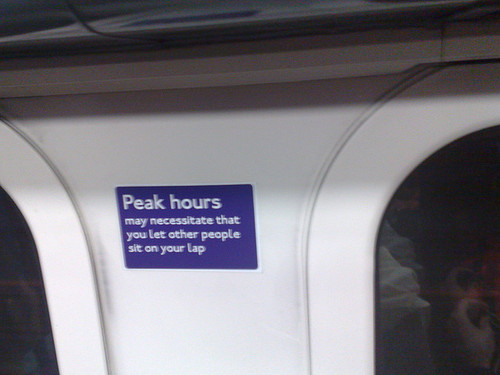
- Fake London Underground signs (via Benjamin Hennig)
[image credit: ? ]
Thursday, January 23, 2014
Blog Updates
Dear readers,
if you like this blog, recommend it to your friends. If you didn't like this blog, recommend it to your enemies. That's fine also.
If you want to receive our updates, you can do this using different alternatives:
Twitter: @UrbDemographics Follow @UrbDemographics
Facebook page:
And via our posts RSS Feed:
 Subscribe in a reader
if you like this blog, recommend it to your friends. If you didn't like this blog, recommend it to your enemies. That's fine also.
If you want to receive our updates, you can do this using different alternatives:
Twitter: @UrbDemographics Follow @UrbDemographics
Facebook page:
And via our posts RSS Feed:
Subscribe in a readerWednesday, January 22, 2014
Chart of the Day
Comparing the Official DOT forecasts of road traffic with actual road traffic.

and more here:
"That overestimate is the equivalent of adding travel from five average-sized states to the total. And the overestimate came in the year of the release, not year 20. This is troubling in a report that is widely regarded as a gauge of the “need” for funding new highway capacity."

Tuesday, January 21, 2014

Monday, January 20, 2014
A day in the life of a city
Oliver Lock points out to this nice visualization of Foursquare check-ins revealing the pulse of London. The Data Team at Foursquare have created a series of videos like this for Istanbul, London, Chicago, Tokyo San Francisco and New York City.
For those interested in the topic, Anastasios Noulas's PhD thesis can work as a good reference: Human Urban Mobility in Location-based Social Networks: Analysis, Models and Applications.

Sunday, January 19, 2014
Quote of the Day
"You can tell whether a man is clever by his answers. You can tell whether a man is wise by his questions." (Naguib Mahfouz)
Soundtrack:
Soundtrack:
Saturday, January 18, 2014
Assorted links
- The soviets bad taste for architecture
- The economic case for scrapping fossil-fuel subsidies (via Paul Barter)
- The newly-created Journal of Demographic Economics (via Bernardo L Queiroz)
- 1 + 2 + 3 + 4 + ... ∞ = -1/12 shocked? (via Tim Harford)
- China has just overtaken America as the world's biggest trader in goods
- Income ineq. and pop. health: An analysis of panel data for 21 developed countries,1975–2006 (via Carl Schmertmann)
- GIF showing the growth of Walmart

[gif credit: Mashable]
Friday, January 17, 2014
off-topic: The truth behind British politeness

Being a Brazilian living in the UK, I am often surprised at how polite the British people can sound. The point is that I'm still struggling to read their real message between the lines.
The Telegraph have published something that might help: a translation table explaining the truth behind British politeness (ht Flavia Marreiro). Here are some of my favorites:
| What the British say | What Foreigners understand | What the British mean |
|---|---|---|
| With the greatest respect | He is listening to me | You are an idiot |
| That's not bad | That's poor | That's good |
| Quite good | Quite good | A bit disappointing |
| I would suggest | Think about the idea, but do what you like | Do it or be prepared to justify yourself |
| Very interesting | They are impressed | That is clearly nonsense |
| I almost agree | He's not far from agreement | I don't agree at all |
| I only have a few minor comments | He has found a few typos | Please rewrite completely |
ps. image credit: LLKC at weheartit.com
Thursday, January 16, 2014

Sunday, January 12, 2014
A Travel Time Map of the Roman Empire
A neat isochronic map! via Patrick Chovanec:

Related Links:
Travel times from Rome, at the time of the Roman Empire in number of days (each shade represents one week). This map is part of the The Stanford Geospatial Network Model of the Roman World. There is also a short video showing how to export data and to navigate the interactive maps of the projecet.
Higher education in BRIC countries: a demographic perspective
The future of higher education in BRIC countries: a demographic perspective. A new paper published by Raquel Guimarães in the Brazilian Journal of Population Studies (REBEP).
Related Links:
Abstract:
In regard to the development and reform of higher education (HE), recent and projected evidence suggest that enrollment growth is likely to be slower than it is at present (or even negative) as a result of ageing populations. The case of the BRIC countries is particularly interesting for the study of the impact of demographic changes on HE because these countries show considerable diversity regarding their demographic transition. This paper explores how demographic changes are likely to affect the demand for higher education in BRIC countries. I argue that these countries are now facing a great expansion of enrollment but, given declining fertility levels, diversification of the HE clientele will become a common strategy. But diversification of the student population will place a new and complex set of demands on HE institutions, and equity in higher education in the near future will depend on how HE systems are structured in these countries.
Related Links:
Saturday, January 11, 2014
Assorted Links
- Mapping Poverty in the US
- On the growth of R and Python for data science
- Proper Science
- Mass production of genetically modified Aedes aegypti for field releases in Brazil
- The University of Oxford has created a 2-year MPhil in Sociology and Demography
- The 100 deadliest movies of all time
- Graduate students... you've just made a terrible life choice
- Apparently income levels are correlated with internet porn viewing habits (the rich watch less porn) via Mark Graham
- Chicago and the Polar Vortex

[image credit: Pilot Hank Cain courtesy Shawn Reynolds]
Wednesday, January 8, 2014


Urban Policies and Public Space Allocation
A couple of months ago, I shared a post with a short presentation by Janette Sadik-Khan talking about the recent low-cost interventions on public space in NY City. The fact is that these interventions have been around for years now, and Clarence Eckerson and the team at Streetfilms have been documenting these changes since their early stages.
Here is one of their short films showing the remarkable before-and-after transformation of several streets and intersections in NY City. (via Sarah Goodyear):
What makes me particularly interested in such urban transformations is the way they make evident the idea that public space is a scarce resource in large cities. Though unnoticed by some policy makers, great cities face a clear resource dilemma in the allocation of public space in general and road space in central areas in particular. In some large cities like London, transport authorities have acknowledged this issue a long time ago.
Deciding upon who should have the priority to use urban space in certain areas of the city (drivers, cyclists, pedestrians and/or public transport users), however, is quite complex. These decisions are complex both because of the technical aspects in the construction of bike lanes, bus lanes and corridors, congestion charging schemes etc. and especially because of the public and political acceptability of such decisions (Banister, 1994).
In the way I like to read these 'urban interventions', they all come down to the role played by policy makers in mediating conflicts that arise from unjust/asymmetrical appropriation of space by individuals and social groups. And as in any other field of public policy, it is crucial to evaluate such urban policies in order to identify those types of interventions that work and to learn from those that do not work. I will probably dedicate more attention to this topic in my research, so hopefully I'll post more on this theme in the future.
Tuesday, January 7, 2014
Transport Controversies, TSU Seminars

In the next three months, the Transport Studies Unit (TSU) at the University of Oxford will be holding a series of seminars covering some Transport Controversies.
Professors like Henry Overman (LSE), Iain Doherty (University of Glasgow) and others will be discussing many interesting topics such as the the spatial implications of High Speed 2 and the distributional aspects of investments in transportinfrastructure.
Saturday, January 4, 2014
Delineating Geographical Regions with telephone call networks
An interesting paper discussing the delimitation of geographical regions and community boundaries, by Michael Szell and colleagues. This study can bring useful insights to the debate on functional urban areas and on the definition of metropolitan boundaries.
Sobolevsky S et al. (2013) Delineating Geographical Regions with Networks of Human Interactions in an Extensive Set of Countries. PLoS ONE 8(12): e81707. doi:10.1371/journal.pone.0081707
Abstract:

Sobolevsky S et al. (2013) Delineating Geographical Regions with Networks of Human Interactions in an Extensive Set of Countries. PLoS ONE 8(12): e81707. doi:10.1371/journal.pone.0081707
Abstract:
Large-scale networks of human interaction, in particular country-wide telephone call networks, can be used to redraw geographical maps by applying algorithms of topological community detection. The geographic projections of the emerging areas in a few recent studies on single regions have been suggested to share two distinct properties: first, they are cohesive, and second, they tend to closely follow socio-economic boundaries and are similar to existing political regions in size and number. Here we use an extended set of countries and clustering indices to quantify overlaps, providing ample additional evidence for these observations using phone data from countries of various scales across Europe, Asia, and Africa: France, the UK, Italy, Belgium, Portugal, Saudi Arabia, and Ivory Coast. In our analysis we use the known approach of partitioning country-wide networks, and an additional iterative partitioning of each of the first level communities into sub-communities, revealing that cohesiveness and matching of official regions can also be observed on a second level if spatial resolution of the data is high enough. The method has possible policy implications on the definition of the borderlines and sizes of administrative regions.
[image credit: Sobolevsky S et al., 2013]
Friday, January 3, 2014
Assorted links
- 100 things we didn't know last year (via Bernardo L Queiroz)
- Quantifying the Advantage of Looking Forward
- The Economis: interactive guide to the world's housing markets
- Where UK immigrants were born: 1951-2011
- Brazil has more ATMs than any other country
- The Google Art Project
- Astrology and birth rates in East Asia
- National Geographic Photo Contest 2013
- The 52 publications most cited by sociologists in 2013 (Based on citation analysis of 1,166 articles published in 39 sociological journals)
- Spatial Patterns of Household Car Ownership in London
click on the image to enlarge it

[image credit: Meead Saberi ]
Thursday, January 2, 2014

Subscribe to:
Posts (Atom)