- Call for papers: IUSSP is organizing a Scientific Panel on the Impact of Internal Migration and Urbanization in Developing Countries. Deadline for submission of abstracts: 1 July 2011 (thanks Joice Melo Vieira for the tip).
- Net Migration cartograms made of LEGO! (Each piece represents 10,000 people)
- Dissertations to be written on Migration and the job market (by Peter Gordon)
- Paper: Changing Patterns and Determinants of Interprovincial Migration in China 1985–2000 (by Jianfa Shen)
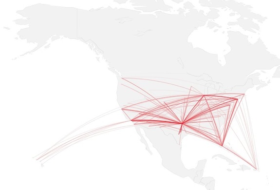
- How to map connections with great circles using R codes.
- Snapshot: Global Migration and U.S. immigration patterns by county since 1880 (two excellent interactive maps by the New York Times - via The Map Room):
Structured Procrastination on Cities, Transport Policy, Spatial Analysis, Demography, R
Wednesday, June 29, 2011
Assorted links on Migration
Tuesday, June 28, 2011
Cities' Areas of Influence in Brazil
Since 1966, the Brazilian Institute of Geography and Statistics (IBGE) has been carrying on a research on the Brazilian network of cities. The project is called REGIC - Regiões de Influência de Cidades (which I would poorly translate as " Cities' Areas of Influence ").
They have recently made available the vector files (shape files) of the latest edition of the research (2007).
Brazilian network of cities (1966 - 2007)
The methodology used in this research has changed a lot from its first edition in 1966. The latest 2007 edition, however, is pretty much excellent. The authors address the Brazilian network and hierarchy of cities based on a massive data set. It incorporates all sort of spatial connections such as:
- Federal public administration
- Business management
- Passengers transport (flight and Road connections)
- Bank branches
- Education institutions
- Health services
- Density of Internet domains
- Television networks and even Destination of agricultural production (I bet I have forgotten something)
Marcadores:
IBGE,
Ipea,
Network,
Urban Evolution,
Urban Hierarchy
Monday, June 27, 2011
Quote of the day
"Cities are the crucible of human civilization, the drivers towards potential disaster, and the source of the solution to humanity's problems. It is therefore crucial that we understand their dynamics, growth and evolution in a scientifically predictable, quantitative way. The difference between 'policy as usual' and policy led by a new quantitative understanding of cities may well be the choice between creating a “planet of slums” or finally achieving a sustainable, creative, prosperous, urbanized world expressing the best of the human spirit."
ps. Keep that in mind. But, remember not to take it as a mantra.
Marcadores:
Quote
Saturday, June 25, 2011
Where refugees come from (and go to)
The latest statistics by UNHCR (UN's High Commission for Refugees) are out. You can download the data here and check the Guardian's article on this topic here.
and don't forget the interactive map by Simon Rogers - via The Global Sociology Blog
Where refugees come from:

and where they go:

Marcadores:
Migration
Monday, June 20, 2011
Copy & Paste Cities
(photo credit: Perseomedusa)
China is getting famous for its empty cities.* Well, China also has its Copied Cities now!! Geoff Manaugh (from BLDGBLOG) wrote an interesting article on this a few days ago (via MR and Urban Planning Blog - thanks Leo Monasterio for the tip).
Marcadores:
China,
Empty City
Interesting Demography Bolgs
(photo credit: Zunia)
Just in case you didn't notice them on the blogroll, there are two interesting demography blogs you should read (leave a comment if you know another one).
There is the Changing Demography blog (by Kenneth W. Gronbach), which is more focused on market demographics. They have an excellent post on The Mysterious Labor Shortage in China.
And there is also the excellent Demography Matters blog (by a group of demographers and other social scientists). They have a lot of good posts to which I often link here.
ps. you might find some usefull Online Databases on the blogroll too.
Marcadores:
Blogs
Wednesday, June 15, 2011
Assorted Links
- Geographical Analysis: 36 years of research digitized (HT Vinicius Netto)
- The new issue of JTLU (Journal of Transport and Land Use)
- Congestion Charging is not really a new idea (via The Transportationist)
- Longevity and public spending - An age-old problem
- Life Expectancy Calculator from BBC's (via @worldmapper)
- Mapping Pedestrian Deaths in the U.S. (via The Map Room)
- Chinese urbanization (Slowing Population Growth, Accelerating Urbanization and Moving East) by Wendell Cox
- New York City in Time-Lapse (by James Ogle via Infrastructurist)
new york city. from James Ogle on Vimeo.
Marcadores:
Assorted links
Monday, June 13, 2011
Seminars on Population Studies at Cedeplar
The Institute is holding a seminar on Current Issues and Frontiers in Demographic Methods, on 13 June 2011. The event is in honour of Professor Jose Alberto de Carvalho, who is certainly one of the greatest Brazilian demographers.
The seminar will be followed on 14 and 15 June by the International Seminar on New Challenges in Population and Development, jointly organized with the IUSSP Scientific Panel on New Challenges in Population and Development.
I congratulate Cedeplar for holding this event. We (Brazilian demographers) thank Prof. Zé Alberto for his work!
Marcadores:
Cedeplar,
Events,
Public Lecture
Thursday, June 9, 2011
Brazilian Census 2010: a few more results
The Brazilian Institute of Geography and Statistics (IBGE) released a few more results of the 2010 Brazilian Census. At their website, you can check out a few maps, charts, compared historical data and population pyramids. (hat tip to Ricardo de Sampaio Dagnino)
ps. sorry about the image borders.... again
Tuesday, June 7, 2011
Cellular automata in your iphone
Now you can have a Cellular Automata (app) model in your iPhone (iPod Touch or iPad). It's the SPEED Sim (aka Spatial Population Ecological and Epidemiological Dynamics Simulator).
Dr. David Hiebeler and his team at the SPEED Lab (Spatial Population Ecological and Epidemiological Dynamics Lab) developed this app that allows you to explore the dynamics of three spatial simulation models.
- Dispersal 2: Population model with local dispersal at distance 1 or 2, and long-distance dispersal.
- SIRS: Spatial epidemiological model.
- Vaccinated communities: Epidemiological model with varying vaccination levels among different communities.
Here you may also access some cellular automata Java applets!
Marcadores:
Modelling
Subscribe to:
Posts (Atom)