Showing posts with label urban mobility. Show all posts

Tuesday, April 7, 2015

Dynamic population mapping using mobile phone data

An interesting study by Pierre Deville showing that it is possible to use data from mobile phone networks to analyze population spatial distribution while guaranteeing phone users’ privacy (via Tim Wallace).

Deville, P., et al. (2014). Dynamic population mapping using mobile phone data.Proceedings of the National Academy of Sciences, 111(45), 15888-15893.


Abstract
During the past few decades, technologies such as remote sensing, geographical information systems, and global positioning systems have transformed the way the distribution of human population is studied and modeled in space and time. However, the mapping of populations remains constrained by the logistics of censuses and surveys. Consequently, spatially detailed changes across scales of days, weeks, or months, or even year to year, are difficult to assess and limit the application of human population maps in situations in which timely information is required, such as disasters, conflicts, or epidemics. Mobile phones (MPs) now have an extremely high penetration rate across the globe, and analyzing the spatiotemporal distribution of MP calls geolocated to the tower level may overcome many limitations of census-based approaches, provided that the use of MP data is properly assessed and calibrated. Using datasets of more than 1 billion MP call records from Portugal and France, we show how spatially and temporarily explicit estimations of population densities can be produced at national scales, and how these estimates compare with outputs produced using alternative human population mapping methods. We also demonstrate how maps of human population changes can be produced over multiple timescales while preserving the anonymity of MP users. With similar data being collected every day by MP network providers across the world, the prospect of being able to map contemporary and changing human population distributions over relatively short intervals exists, paving the way for new applications and a near real-time understanding of patterns and processes in human geography.

Seasonal changes in population distribution in Portugal and France

Monday, July 7, 2014

How we move in cities

A short post about a few great visualizations of how we move in cities*:

Mark Byrnes writes about the iPhone app Human, that has already tracked 7.5 million miles traveled by their users using different transport modes in 30 different cities.


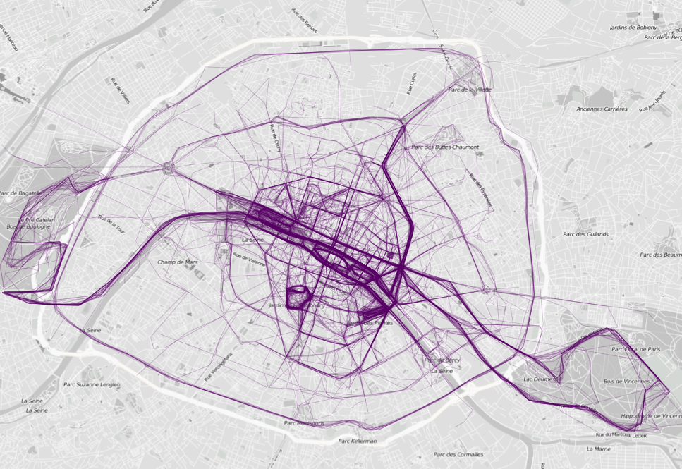
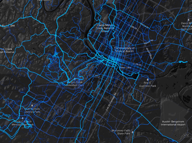
Nathan Yau also point out to two mobile apps that collect data about where people run and bike in major cities: RunKeeper  and Strava.


* There are many other projects dedicated to capture human mobility patterns in our cities using a wide variety of data sources and visualization techniques. It would be barely impossible to cover all of them. Here is a list with some of the projects I have crossed with: 

Wednesday, January 8, 2014

Urban Policies and Public Space Allocation

A couple of months ago, I shared a post with a short presentation by Janette Sadik-Khan talking about the recent low-cost interventions on public space in NY City. The fact is that these interventions have been around for years now, and Clarence Eckerson and the team at Streetfilms have been documenting these changes since their early stages.

Here is one of their short films showing the remarkable before-and-after transformation of several streets and intersections in NY City. (via Sarah Goodyear):


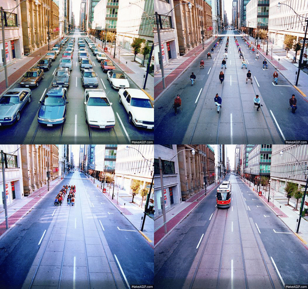
What makes me particularly interested in such urban transformations is the way they make evident the idea that public space is a scarce resource in large cities. Though unnoticed by some policy makers, great cities face a clear resource dilemma in the allocation of public space in general and road space in central areas in particular. In some large cities like London, transport authorities have acknowledged this issue a long time ago.

Deciding upon who should have the priority to use urban space in certain areas of the city (drivers, cyclists, pedestrians and/or public transport users), however, is quite complex. These decisions are complex both because of the technical aspects in the construction of bike lanes, bus lanes and corridors, congestion charging schemes etc. and especially because of the public and political acceptability of such decisions (Banister, 1994).

In the way I like to read these 'urban interventions', they all come down to the role played by policy makers in mediating conflicts that arise from unjust/asymmetrical appropriation of space by individuals and social groups. And as in any other field of public policy, it is crucial to evaluate such urban policies in order to identify those types of interventions that work and to learn from those that do not work. I will probably dedicate more attention to this topic in my research, so hopefully I'll post more on this theme in the future.


Thursday, December 12, 2013

Equity Issues in Transport Policy

As some of you may know, I have just started my PhD and I will be focusing on 'Equity Issues in Transport Policies' with bits of spatial and demographic analysis.

So I was very glad to watch this short talk by Enrique Peñalosa (former mayor of Bogota): 'Why buses represent democracy in action'. You know, it's always good to hear big names saying you're working on important problems.


Wednesday, November 20, 2013

Detailed Animation of Travel Surveys

Despite the amazing potential of new technologies (eg social media, mobile phones) to inform us about spatial patterns in urban mobility, traditional Household Travel Surveys are still a key source of data with preciously detailed information on socio-economic and demographic characteristics.

Recently, Fletcher Foti (Ph.D. student at Berkeley) created a striking detailed animation daily travel patterns using the most recent surveys from the San Francisco Bay Area, Los Angeles, and New York. You may check the animation here and have more information at Emily Badger's post.

ps. If you are interested in travel surveys, you should take a look at the Related Links, below.

[Image Credit: Fletcher Foti, Synthicity]

Wednesday, November 13, 2013

Low-cost interventions on public space

A short presentation by Janette Sadik-Khan (New York transportation comissioner) talking about the recent low-cost interventions on public space in NY. I am keen to read new studies assessing these interventions under different perspectives (urban mobility, housing, segregation, accessibility, real state, market sales etc). I hope there is someone out there doing research on this.

Monday, August 26, 2013

Global Innovation and Diffusion in Public Transport

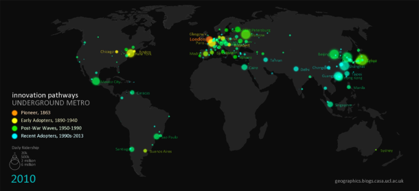
Duncan A Smith has created some great animations of 'Global Innovation Diffusion in Public Transport'. Here is the video showing the diffusion of BRT systems. Neat work! You should check it out the other videos.

Animating Global Innovation Diffusion- Bus Rapid Transit from Duncan A Smith on Vimeo.


[Image Credit: Duncan A Smith]

Thursday, July 4, 2013

Wednesday, June 26, 2013

A universal model for mobility patterns

This is one of the best papers I have read in the last few years. Neat stuff! 

Simini, F; Gonzalez. MC; Maritan; A; Barabasi, AL. (2012). A universal model for mobility and migration patterns. Nature 484, 96–100. (ungated link)

Abstract:
Introduced in its contemporary form in 1946, but with roots that go back to the eighteenth century, the gravity law is the prevailing framework with which to predict population movement, cargo shipping volume and inter-city phone calls, as well as bilateral trade flows between nations. Despite its widespread use, it relies on adjustable parameters that vary from region to region and suffers from known analytic inconsistencies. Here we introduce a stochastic process capturing local mobility decisions that helps us analytically derive commuting and mobility fluxes that require as input only information on the population distribution. The resulting radiation model predicts mobility patterns in good agreement with mobility and transport patterns observed in a wide range of phenomena, from long-term migration patterns to communication volume between different regions. Given its parameter-free nature, the model can be applied in areas where we lack previous mobility measurements, significantly improving the predictive accuracy of most of the phenomena affected by mobility and transport processes.

ps. I've postponed this post for far too long because I was planning to start a study with some testing on the radiation model using Brazilian data (commuting, migration, national flights). However, I might face some (good!) turbulence in my professional/academic life in the next few months and I don't know when I'll get time for that.

Commuting landscapes (Fig 4)
[Image Source: Simini et al, 2011]

Thursday, June 20, 2013

Today Will Be Bigger

One more post about the recent events in Brazil. This is probably one of the most exciting/moving moments of the protests in front of Brazil's National Congress in Brasília (17/06/2013).


Zero-fare public transport is one of the major  infeasible  demands. Apart from the emotional turmoil, Leo Monasterio reminds us that congestion pricing and free parking are little spoken about by the protesters.


Tuesday, June 18, 2013

About the recent protests in Brazil

"As many as 200,000 people have marched through the streets of Brazil's biggest cities, as protests over rising public transport costs and the expense of staging the 2014 World Cup have spread. […] The protests are the largest seen in Brazil for more than 20 years." 
The recent protests in Brazil are receiving a wide and somewhat heterogeneous coverage from the international media. The best piece I have read is this one from The Economist. It gives a broad and sensible idea of what is in stake.

I’d also like to share two studies  self-promotion alert : the first study shows a marked rise in urban bus fares over the recent decades in Brazil (the Portuguse version has been published in a peer-reviewed journal - ungated link here); the second study shows a detailed analysis on household expenditures on public and private transport in Brazil (this one is written in Portuguese only but it has an Abstract in English).


[Sad but still funny... Image credit: Turkish grandma]


ps. I’m not going to write my opinion on the recent protests in Brazil for two reasons. First, I have mixed feelings about it. I’m proud and at the same time confused not knowing what to expect. Second, from the beginning I’ve decided this would not be an opinion blog because it would demand from me two things I don’t have: strong opinions and ability with words.


Related Links:

Monday, June 10, 2013

The size of bike-sharing systems Worldwide

A couple of years ago we have posted a map comparing some subway systems at the same scale. Based on a similar idea, David Yanofsky has made a very nice map comparing the size of 29 bike-sharing systems around the world. He has used data from an excellent work by Oliver O’Brien with interactive maps including all those cities.


ps. I saw this at Dug's blog (Map of the Week), where he has gathered other interesting visualizations of bike sharing systems*.


[Image Credit: David Yanofsky]


* Related Links:

Thursday, May 2, 2013

Using Cell-Phone Data to Improve our Cities

Imagine what questions you could answer if you had access to movement data collected from millions of cell-phone users. These kind of data bring and endless potential for research in several areas such as transportation, epidemiology, social networks and civil defense. MIT is holding this week the NetMob 2013 Conference, a conference focused on mobile phone data analysis. There are several interesting papers that are really pushing the envelope.


A paper by Francesco Calabrese and colleagues stands out as they have developed an interactive system to optimize public transit networks using mobile phone data under the Orange D4D Challenge*. Still, I believe there's something to improve in using such kind of data in a way that differentiates people from higher and lower income groups.


*Orange, a big telecom carrier, lauched a challenge last year called "Data for Development" (D4D). In short, you could send them a 250-words research project and get access within a week to a really large mobile phone dataset containing 2.5 billion records (calls and text messages) exchanged between 5 million anonymous users in Ivory Cost. Many papers presented at NetMob 2013 Conference were developed using Orange D4D data.

By the way, the Senseable City Lab (MIT) is also working on a related project (Signature of Humanity) trying to look at mobility patterns comparing New York, London, and Hong Kong. Here's a promotional video:

Monday, April 22, 2013

An experimental confirmation of the Spatial Mismatch Hypothesis

Self-recommending: Getting to Work: Experimental Evidence on Job Search and Transportation Costs, by David Phillips.

Abstract:
In urban areas job vacancies often exist but poor, minority residents tend to be concentrated in neighborhoods with limited geographic access to these jobs. Using a randomized field experiment with public transit subsidies, I test whether this spatial mismatch of workers from jobs causes poor labor market outcomes. Randomly selected clients of a non-profit employment agency received a public transit subsidy to assist in applying to jobs and attending interviews with potential employers. I find evidence that the transit subsidies have a large, short-run effect in reducing unemployment durations with treatment causing the probability of finding employment within 40 days to increase by 9 percentage points, from 0.26 to 0.35. After 90 days, this difference narrows to a large but statistically insignificant 5 percentage points. I find weaker evidence that this decrease in unemployment duration results from more intense search behavior, with the transit subsidy group applying to more jobs and jobs further from home. To my knowledge, these results provide the first experimental confirmation that spatial mismatch of workers from jobs can cause adverse labor market outcomes for poor, urban individuals.
This study was presented last year at a conference on 'Research on Urban Mass Housing' that took place at Oxford. Nice programme, by the way.